The route starts at the “Cordel de La Viña” junction, next to the N-321 highway and at the entrance to the town of “La Viña”, a typical village on the muleteer’s path where various historical itineraries converged. After crossing the population center, the route goes through magnificent examples of autochthonous holm oak forest to reach the interesting “Hacienda Cortijo del Llano”.
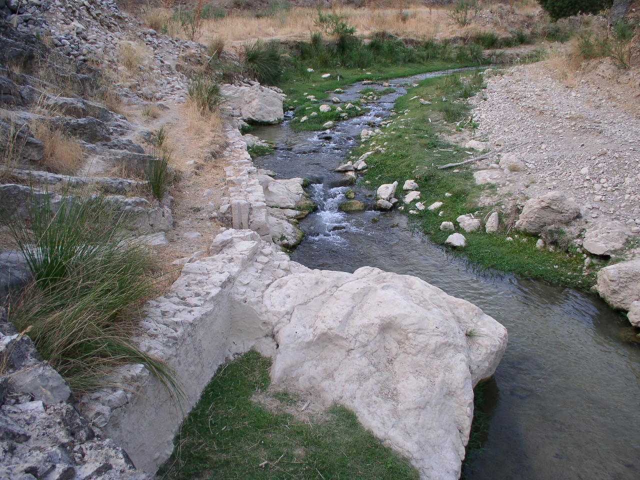
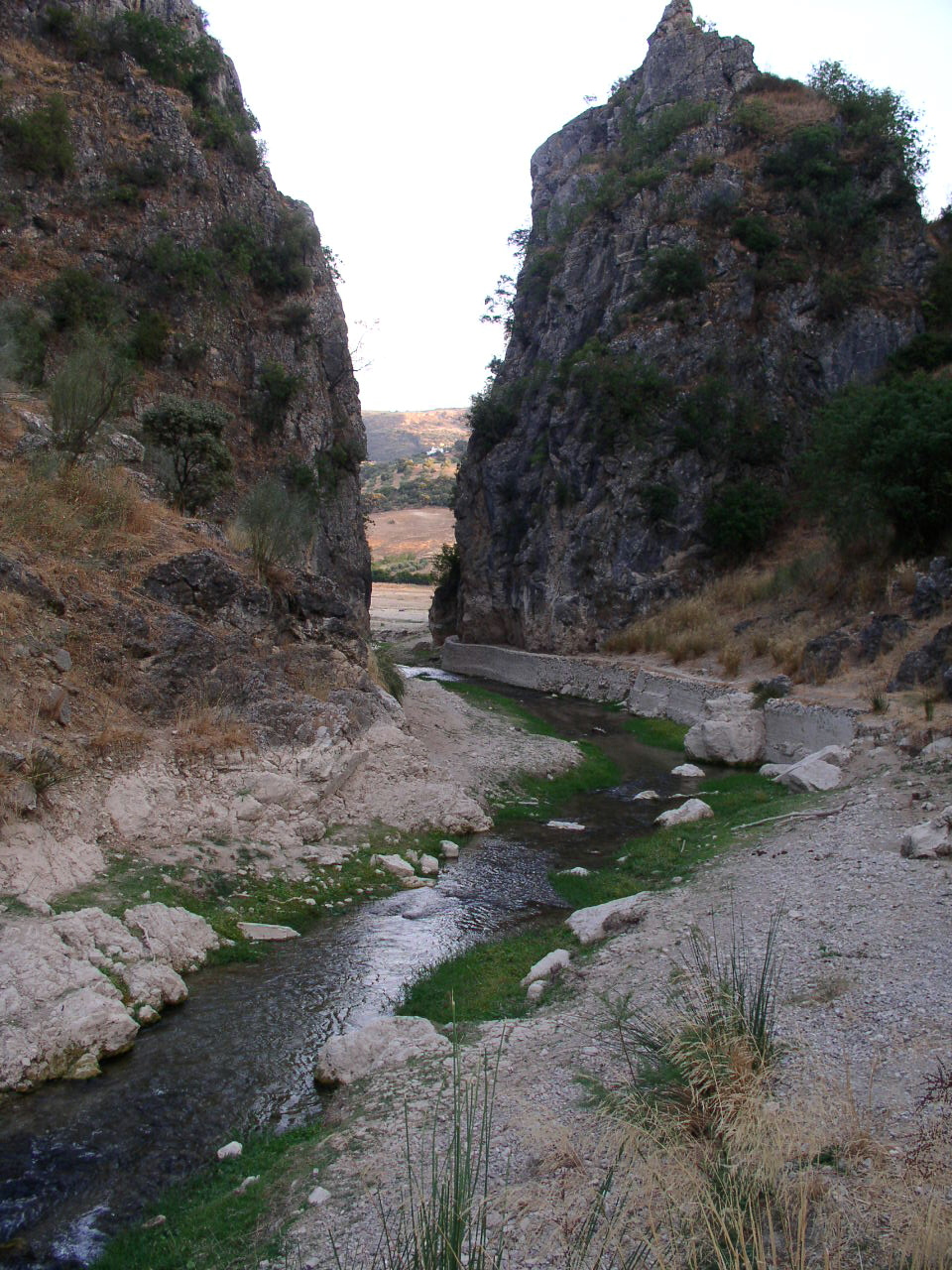
From this plateau area, the itinerary descends rapidly towards the environment of “La Ratonera”, of great biodiversity and patrimonial quality and, after going parallel to the “Arroyo de La Viña”, crosses the bridge in the “Arroyo Blanquillo”. Then it ascends slightly through different farmhouses, to once again descend the entire stream (which also delimits the municipalities of Algarinejo and Zagra) to the exceptional enclave of the “Río Pesquera-Tajos Cerradura”, the starting point of the “Parque Cesna Tourist Network”. .
environmental
We are in an environment of narrow valleys that emerge over the small plains, where the “Sierra de La Tosquilla” to the west and the foothills of the “Sierra de Chanzas” to the east stand out. But perhaps its greatest interest lies in the variety of its rivers: Arroyo de La Viña, Río Blanquillo and Río Pesquera, and the presence of enclaves such as the Tajos de Cerradura and the tails of the Iznájar reservoir, with a succession of deep pools and tables interesting. We will observe continuous changes in the landscape, as a reflection of an itinerary that passes through different wooded masses, some of them relicts of the old Mediterranean forest before being displaced by extensive olive groves: the holm oak groves in the old cattle pass, the remnants from the gallery forest of “La Ratonera” or the lower area of the “Río Blanquillo”, where poplars intermingle with willows, elms, reed beds and tamarisk.
It is known that the areas surrounding permanent water flows act as true ecological corridors for fauna. Therefore, it is not surprising that we can observe species such as the Marten, the Marten, the Bonelli’s Eagle, the Osprey (in migratory passage), the Otter, the Gray Heron, and various waders (sandpiel, stilts, plovers). But the fish species could not be missing either, with exceptional rises of Andalusian Barb, the introduced Black-Bass, the Rainbow Trout and the abundant Carp.

Cultural
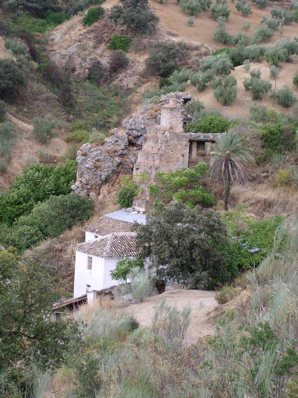
The route travels over an old muleteer pass that moved goods between Loja and Priego, having “La Viña” as a resting place. The muleteers moved certain basic products for the local economy such as bitumen, yarn, salt, salted fish that came from the coast of Malaga, cordage, etc. Marking this road along which rehalas or caravans of stables circulated, there is a rich ethnological heritage with ancient farmhouses, bridges, cobbled medieval roads, stone quarries for masonry and mills. Outstanding enclaves such as Cortijo El Llano (I-III/IV), a 17th century hacienda and La Ratonera, an area of great landscape quality with an interesting medieval cube mill made of large squared ashlars. Numerous well-preserved farmhouses appear on the route, highlighting the Cortijo de las Juntas as a type of traditional habitat with an almost original appearance.
The route ends in the exceptional Enclave of La Cerradura, where there are remains of medieval bridges, an interesting network of ditches and a bucket mill with a double jump from the Nasrid period (S.XIV). At this strategic crossroads, two routes of great historical interest were joined, the muleteer route itself to La Viña and the Vereda Real de Loja to Iznájar; The latter went into the historic Tierras de Cesna in the direction of Iznájar.